
Indramayu topographic map
Interactive map
Click on the map to display elevation.
About this map
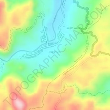
Name: Indramayu topographic map, elevation, terrain.
Average elevation: 1,076 ft
Minimum elevation: 692 ft
Maximum elevation: 1,581 ft
Other topographic maps
Click on a map to view its topography, its elevation and its terrain.
Sukarami
Indonesia > South Sumatra > Muara Enim
Sukarami, Sungai Rotan, Muara Enim, South Sumatra, Indonesia
Average elevation: 30 ft