
Temerloh topographic map
Interactive map
Click on the map to display elevation.
About this map
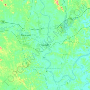
Name: Temerloh topographic map, elevation, terrain.
Location: Temerloh, Pahang, 28000, Malaysia (3.28833 102.25757 3.60833 102.57757)
Average elevation: 157 ft
Minimum elevation: 62 ft
Maximum elevation: 699 ft
Other topographic maps
Click on a map to view its topography, its elevation and its terrain.
Kampung Tebing Tinggi
Kampung Tebing Tinggi, Temerloh, Pahang, Malaysia
Average elevation: 118 ft