Geolocate

Bridgeport topographic map

Click on the map to display elevation.

About this map

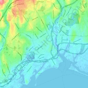
Name: Bridgeport topographic map, elevation, terrain.

Location: Bridgeport, Fairfield County, Connecticut, United States (41.13990 -73.24407 41.22962 -73.15372)

Average elevation: 66 ft

Minimum elevation: -26 ft

Maximum elevation: 331 ft

Fairfield County trails, hiking, mountain biking, running and outdoor activities

Gear up for your next adventure:

🔭Telescopic Hiking Pole - Adjustable pole for hiking stability
Solar GPS Watches - Advanced multisport watches with built-in topographic maps
🛡️Bear Spray Outdoor - Protection in bear country hikes
🔌USB Car Charger - Car charger for on‑the‑go power needs
🔊Portable Camp Speaker - Music and alerts at camp

As an Amazon Associate, this site earns from qualifying purchases at no extra cost to you.