
朱家尖岛 topographic map
Interactive map
Click on the map to display elevation.
About this map
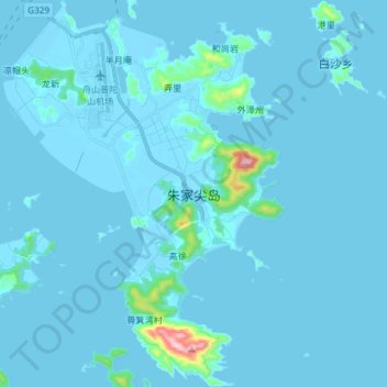
Name: 朱家尖岛 topographic map, elevation, terrain.
Location: 朱家尖岛, 普陀区, 舟山市, 浙江省, 中国 (29.83140 122.32339 29.95988 122.43170)
Average elevation: 46 ft
Minimum elevation: -26 ft
Maximum elevation: 1,198 ft
Other topographic maps
Click on a map to view its topography, its elevation and its terrain.