
Panacea topographic map
Click on the map to display elevation.
About this map
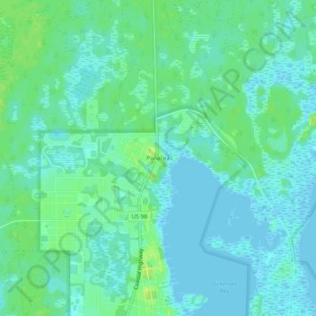
Name: Panacea topographic map, elevation, terrain.
Location: Panacea, Wakulla County, Florida, 32346, United States (30.01611 -84.40885 30.05611 -84.36885)
Average elevation: 20 ft
Minimum elevation: -7 ft
Maximum elevation: 52 ft
Wakulla County trails, hiking, mountain biking, running and outdoor activities
Other topographic maps
Click on a map to view its topography, its elevation and its terrain.
Edward Ball Wakulla Springs State Park
United States > Florida > Wakulla County
Average elevation: 26 ft