
Thank you for supporting this site ❤️
Make a donation
Make a donation
Gear up for your next adventure:
As an Amazon Associate, this site earns from qualifying purchases at no extra cost to you.
Kenefic topographic map
Click on the map to display elevation.
Thank you for supporting this site ❤️
Make a donation
Make a donation
Gear up for your next adventure:
As an Amazon Associate, this site earns from qualifying purchases at no extra cost to you.
About this map
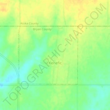
Name: Kenefic topographic map, elevation, terrain.
Location: Kenefic, Bryan County, Oklahoma, États-Unis d'Amérique (34.14291 -96.37297 34.15719 -96.35551)
Average elevation: 669 ft
Minimum elevation: 623 ft
Maximum elevation: 705 ft
Thank you for supporting this site ❤️
Make a donation
Make a donation
Gear up for your next adventure:
As an Amazon Associate, this site earns from qualifying purchases at no extra cost to you.