
Thank you for supporting this site ❤️
Make a donation
Make a donation
Gear up for your next adventure:
As an Amazon Associate, this site earns from qualifying purchases at no extra cost to you.
Tampusu topographic map
Click on the map to display elevation.
Thank you for supporting this site ❤️
Make a donation
Make a donation
Gear up for your next adventure:
As an Amazon Associate, this site earns from qualifying purchases at no extra cost to you.
About this map
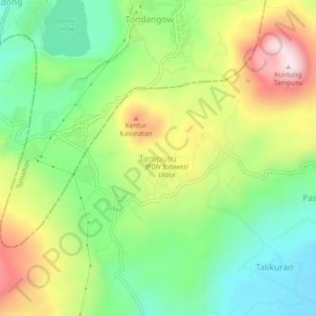
Name: Tampusu topographic map, elevation, terrain.
Location: Tampusu, Minahasa, North Sulawesi, 95618, Indonesia (1.23381 124.81817 1.27381 124.85817)
Average elevation: 2,884 ft
Minimum elevation: 2,244 ft
Maximum elevation: 3,848 ft
Thank you for supporting this site ❤️
Make a donation
Make a donation
Gear up for your next adventure:
As an Amazon Associate, this site earns from qualifying purchases at no extra cost to you.