
Thank you for supporting this site ❤️
Make a donation
Make a donation
Gear up for your next adventure:
As an Amazon Associate, this site earns from qualifying purchases at no extra cost to you.
Södra Sandby topographic map
Click on the map to display elevation.
Thank you for supporting this site ❤️
Make a donation
Make a donation
Gear up for your next adventure:
As an Amazon Associate, this site earns from qualifying purchases at no extra cost to you.
About this map
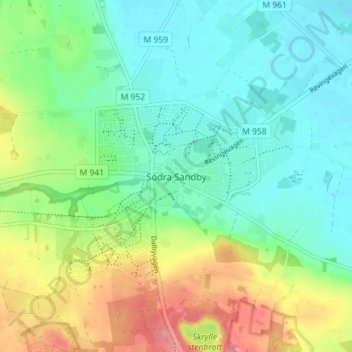
Name: Södra Sandby topographic map, elevation, terrain.
Location: Södra Sandby, Lund Municipality, Skåne County, 247 31, Sweden (55.69717 13.32743 55.73717 13.36743)
Average elevation: 151 ft
Minimum elevation: 59 ft
Maximum elevation: 331 ft
Thank you for supporting this site ❤️
Make a donation
Make a donation
Gear up for your next adventure:
As an Amazon Associate, this site earns from qualifying purchases at no extra cost to you.