Geolocate

Bothell topographic map

Click on the map to display elevation.

About this map

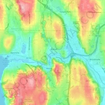
Name: Bothell topographic map, elevation, terrain.

Location: Bothell, King County, Washington, 98041, United States (47.71987 -122.24683 47.79987 -122.16683)

Average elevation: 220 ft

Minimum elevation: -7 ft

Maximum elevation: 531 ft

King County trails, hiking, mountain biking, running and outdoor activities

Gear up for your next adventure:

🧦Hiking Socks - Comfortable socks to prevent blisters on long hikes
🪶Camping Sleeping Pad - Comfortable sleeping pad for backpacking
🛌Ultralight Sleeping Bags - Compact down bags for cold nights in the wilderness
🛡️Insect Repellent - Protection against bugs during outdoor activities
🌄Hiking Binoculars - Compact binoculars for scenic views and trail spotting

As an Amazon Associate, this site earns from qualifying purchases at no extra cost to you.