Geolocate

Foxworth topographic map

Click on the map to display elevation.

About this map

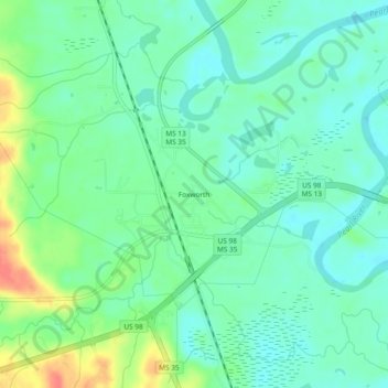
Name: Foxworth topographic map, elevation, terrain.

Location: Foxworth, Marion County, Mississippi, 39483, United States (31.21823 -89.88869 31.25823 -89.84869)

Average elevation: 157 ft

Minimum elevation: 105 ft

Maximum elevation: 279 ft

Marion County trails, hiking, mountain biking, running and outdoor activities

Gear up for your next adventure:

🦶Hiking Gaiters - Keep debris and water out of your boots
🧭GPS Watch Accessories - Bands and chargers for GPS watches
📱Solar Portable Charger - Solar power bank for charging devices off‑grid
🌲Outdoor Survival Books - Best books on survival skills
🏫Relief Map Kits - Hands-on tools for teaching landforms and elevation

As an Amazon Associate, this site earns from qualifying purchases at no extra cost to you.