Geolocate

Kheda topographic map

Click on the map to display elevation.

About this map

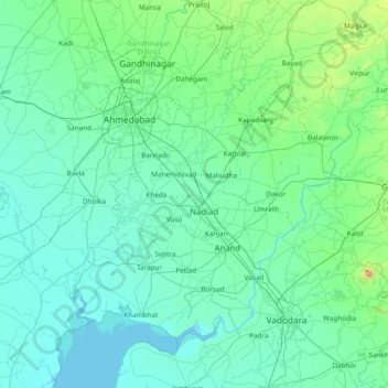
Name: Kheda topographic map, elevation, terrain.

Location: Kheda, Kheda District, Gujarat, 387320, India (22.05000 72.13333 23.45000 73.53333)

Average elevation: 174 ft

Minimum elevation: -3 ft

Maximum elevation: 2,474 ft

Gear up for your next adventure:

🦟Ultrasonic Repellers - Create a bug-free zone at your camp or rest stop
🥾Women's Hiking Boots - Top-rated trail boots with ankle support and superior grip
🧭GPS Watch Accessories - Bands and chargers for GPS watches
🧷Carabiner Set - Durable clips for gear attachment
🦶Carbon Trekking Poles - Reduce knee impact on steep descents with ultra-light poles

As an Amazon Associate, this site earns from qualifying purchases at no extra cost to you.