
Thank you for supporting this site ❤️
Make a donation
Make a donation
Gear up for your next adventure:
As an Amazon Associate, this site earns from qualifying purchases at no extra cost to you.
Dupnitsa topographic map
Click on the map to display elevation.
Thank you for supporting this site ❤️
Make a donation
Make a donation
Gear up for your next adventure:
As an Amazon Associate, this site earns from qualifying purchases at no extra cost to you.
About this map
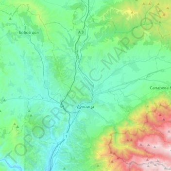
Name: Dupnitsa topographic map, elevation, terrain.
Location: Dupnitsa, Kyustendil, 2604, Bulgaria (42.17494 23.00144 42.41091 23.31990)
Average elevation: 2,782 ft
Minimum elevation: 1,260 ft
Maximum elevation: 8,652 ft
Thank you for supporting this site ❤️
Make a donation
Make a donation
Gear up for your next adventure:
As an Amazon Associate, this site earns from qualifying purchases at no extra cost to you.