Geolocate

Popayán topographic map

Click on the map to display elevation.

About this map

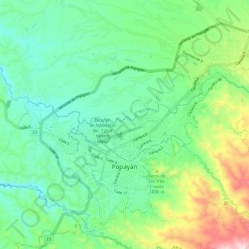
Name: Popayán topographic map, elevation, terrain.

Location: Popayán, Centro, Cauca, Colombia (2.41927 -76.64851 2.49719 -76.55257)

Average elevation: 5,830 ft

Minimum elevation: 5,335 ft

Maximum elevation: 7,100 ft

Gear up for your next adventure:

🔦Compact Flashlight - Reliable flashlight for emergencies
👖Convertible Hiking Pants - Versatile zip-off pants for changing altitudes and temperatures
🏫Relief Map Kits - Hands-on tools for teaching landforms and elevation
🧷Carabiner Set - Durable clips for gear attachment
🗺️NatGeo Topo Maps - High-quality waterproof printed topographic maps of US Parks

As an Amazon Associate, this site earns from qualifying purchases at no extra cost to you.