
Sylacauga topographic map
Click on the map to display elevation.
About this map
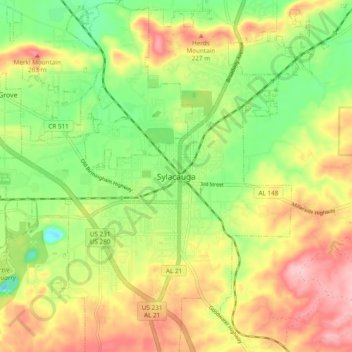
Name: Sylacauga topographic map, elevation, terrain.
Location: Sylacauga, Talladega County, Alabama, 35150, United States (33.13317 -86.29164 33.21317 -86.21164)
Average elevation: 620 ft
Minimum elevation: 348 ft
Maximum elevation: 925 ft
Talladega County trails, hiking, mountain biking, running and outdoor activities