
Duck topographic map
Click on the map to display elevation.
About this map
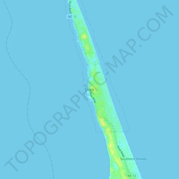
Name: Duck topographic map, elevation, terrain.
Location: Duck, Dare County, North Carolina, United States (36.13001 -75.79593 36.21001 -75.71593)
Average elevation: 3 ft
Minimum elevation: -3 ft
Maximum elevation: 56 ft
Dare County trails, hiking, mountain biking, running and outdoor activities