
Thank you for supporting this site ❤️
Make a donation
Make a donation
Gear up for your next adventure:
As an Amazon Associate, this site earns from qualifying purchases at no extra cost to you.
Ellange topographic map
Click on the map to display elevation.
Thank you for supporting this site ❤️
Make a donation
Make a donation
Gear up for your next adventure:
As an Amazon Associate, this site earns from qualifying purchases at no extra cost to you.
About this map
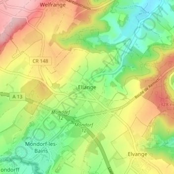
Name: Ellange topographic map, elevation, terrain.
Location: Ellange, Mondorf-les-Bains, Canton Remich, 5690, Luxembourg (49.50101 6.27771 49.54101 6.31771)
Average elevation: 807 ft
Minimum elevation: 541 ft
Maximum elevation: 1,135 ft
Thank you for supporting this site ❤️
Make a donation
Make a donation
Gear up for your next adventure:
As an Amazon Associate, this site earns from qualifying purchases at no extra cost to you.