Geolocate

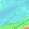
Osgoode topographic map

Click on the map to display elevation.

About this map

Name: Osgoode topographic map, elevation, terrain.

Location: Osgoode, Ottawa, Est de l'Ontario, Ontario, K0A 2W0, Canada (45.12088 -75.63546 45.16088 -75.59546)

Average elevation: 295 ft

Minimum elevation: 269 ft

Maximum elevation: 325 ft

Other topographic maps

Click on a map to view its topography, its elevation and its terrain.
Gloucester

Canada > Ontario > Ottawa

Average elevation: 266 ft

Ottawa

Canada > Ontario > Ottawa

Average elevation: 305 ft

Parc de l'île Pétrie

Canada > Ontario > Ottawa

Average elevation: 151 ft

Baie

Canada > Ontario > Ottawa

Average elevation: 269 ft

Osgoode

Canada > Ontario > Ottawa > Osgoode

Average elevation: 282 ft

Cumberland

Canada > Ontario > Ottawa

Average elevation: 246 ft

Orléans

Canada > Ontario > Ottawa

Orléans se trouve dans le coude septentrional de la Loire, qui la traverse d'est en ouest. La ville appartient au secteur de la vallée de la Loire situé entre Sully-sur-Loire et Chalonnes-sur-Loire, qui a été classé patrimoine mondial de l'humanité par l'UNESCO en l'an 2000. Dans les années 1960 a…

Average elevation: 253 ft

Parc Connaught

Canada > Ontario > Ottawa

Average elevation: 249 ft

Baie

Canada > Ontario > Ottawa

Average elevation: 269 ft

Gear up for your next adventure:

🗺️Topographic Maps - Detailed topo maps for hiking, exploring and outdoor navigation
🎒Gear Packing Cubes - Organize your backpack efficiently
🪶Thermal Camp Blanket - Extra warmth for cold nights
🪶Trail Camera - Capture wildlife on your hikes
📻Weather Alert Radios - Stay informed of storm risks while off-the-grid

As an Amazon Associate, this site earns from qualifying purchases at no extra cost to you.