
Bahrenfeld topographic map
Interactive map
Click on the map to display elevation.
About this map
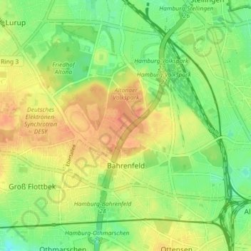
Name: Bahrenfeld topographic map, elevation, terrain.
Location: Bahrenfeld, Altona, Hambourg, 22761, Allemagne (53.55842 9.86476 53.59290 9.93531)
Average elevation: 95 ft
Minimum elevation: 30 ft
Maximum elevation: 157 ft
Other topographic maps
Click on a map to view its topography, its elevation and its terrain.
Fuhlsbüttel
Allemagne > Hambourg > Hambourg
Fuhlsbüttel, Hamburg-Nord, Hambourg, Allemagne
Average elevation: 62 ft
Binnenalster
Allemagne > Hambourg > Hambourg
Binnenalster, Ballindamm, Hamburg-Altstadt, Hamburg-Mitte, Hambourg, 20095, Allemagne
Average elevation: 43 ft