Geolocate

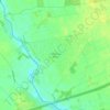
Boothstown topographic map

Click on the map to display elevation.

About this map

Name: Boothstown topographic map, elevation, terrain.

Location: Boothstown, Salford, Greater Manchester, England, M28 1LT, United Kingdom (53.48295 -2.43873 53.52295 -2.39873)

Average elevation: 135 ft

Minimum elevation: 49 ft

Maximum elevation: 292 ft

Other topographic maps

Click on a map to view its topography, its elevation and its terrain.
Irlam

United Kingdom > England > Salford

Average elevation: 69 ft

Crescent Meadow

United Kingdom > England > Salford

Average elevation: 118 ft

Botany Bay Wood

United Kingdom > England > Salford > Worsley > Barton Moss

Average elevation: 75 ft

Peel Park

United Kingdom > England > Salford

Average elevation: 118 ft

Gear up for your next adventure:

🔋Rechargeable Batteries - Power up your outdoor devices
🥾Women's Hiking Boots - Top-rated trail boots with ankle support and superior grip
🪶Camping Sleeping Pad - Comfortable sleeping pad for backpacking
📶Satellite Messenger - Communication device off‑grid
🪶Trail Camera - Capture wildlife on your hikes

As an Amazon Associate, this site earns from qualifying purchases at no extra cost to you.