Geolocate

Chott el-Jérid topographic map

Interactive map

Click on the map to display elevation.

About this map

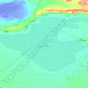
Name: Chott el-Jérid topographic map, elevation, terrain.

Location: Chott el-Jérid, ‫‪Bichni‬‬‬ ‫‪Edarjin‬‬, El Faouar, Kébili, Tunisie (33.43752 7.76795 34.02513 8.90739)

Average elevation: 141 ft

Minimum elevation: -92 ft

Maximum elevation: 2,631 ft

Other topographic maps

Click on a map to view its topography, its elevation and its terrain.

Douz

Tunisie > Kébili > Douz

Douz, Elabadla, Douz Nord, Kébili, 4215, Tunisie

Average elevation: 207 ft

Kebili

Tunisie > Kébili > Kebili

Kebili, Janoura, Kebili Nord, Kébili, 4200, Tunisie

Average elevation: 141 ft