Geolocate

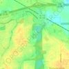
Sunshine Village topographic map

Click on the map to display elevation.

About this map

Name: Sunshine Village topographic map, elevation, terrain.

Location: Sunshine Village, Montgomery, Montgomery County, Alabama, 36119, United States (32.37597 -86.22886 32.41597 -86.18886)

Average elevation: 213 ft

Minimum elevation: 157 ft

Maximum elevation: 325 ft

Other topographic maps

Click on a map to view its topography, its elevation and its terrain.
Fain Park

United States > Alabama > Montgomery County > Montgomery

Average elevation: 230 ft

Gear up for your next adventure:

🔭Compact Binoculars - HD vision for scouting terrain and identifying distant landmarks
🧥Men's Rain Shells - Premium waterproof and breathable jackets for mountain weather
🎒Day Hiking Backpack - Lightweight backpack perfect for day trips and outdoor adventures
🧺Microfiber Travel Towels - Compact and fast-drying towels for trail use
🩳Quick‑Dry Hiking Shorts - Comfortable and quick‑dry shorts for summer hiking

As an Amazon Associate, this site earns from qualifying purchases at no extra cost to you.