
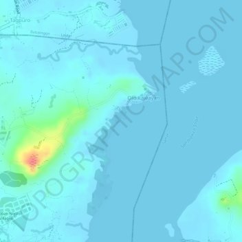
Magsumbul Diutay Island topographic map
Interactive map
Click on the map to display elevation.
About this map
Name: Magsumbul Diutay Island topographic map, elevation, terrain.
Average elevation: 20 ft
Minimum elevation: -7 ft
Maximum elevation: 233 ft
Other topographic maps
Click on a map to view its topography, its elevation and its terrain.
Tacloban
Philippines > Leyte > Tacloban
Tacloban, Leyte, Eastern Visayas, 6500, Philippines
Average elevation: 95 ft
Tagpuro
Philippines > Leyte > Tacloban
Tagpuro, Tacloban, Leyte, Eastern Visayas, Philippines
Average elevation: 39 ft
Barangay 73
Philippines > Leyte > Tacloban > Barangay 73
Barangay 73, Tacloban, Leyte, Eastern Visayas, 6500, Philippines
Average elevation: 112 ft