Geolocate

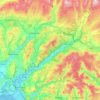
Banwen topographic map

Click on the map to display elevation.

About this map

Name: Banwen topographic map, elevation, terrain.

Location: Banwen, Onllwyn, Neath Port Talbot, Wales, SA10 9LH, United Kingdom (51.75449 -3.68114 51.79449 -3.64114)

Average elevation: 899 ft

Minimum elevation: 571 ft

Maximum elevation: 1,572 ft

Other topographic maps

Click on a map to view its topography, its elevation and its terrain.
River Neath

United Kingdom > Wales > Neath Port Talbot > Resolven

Average elevation: 892 ft

Glynneath

United Kingdom > Wales > Neath Port Talbot

Average elevation: 807 ft

Cilybebyll

United Kingdom > Wales > Neath Port Talbot > Gellinudd

Average elevation: 587 ft

Pelenna

United Kingdom > Wales > Neath Port Talbot

Average elevation: 712 ft

Crynant

United Kingdom > Wales > Neath Port Talbot

Average elevation: 761 ft

Neath

United Kingdom > Wales > Neath Port Talbot

Average elevation: 233 ft

Pontardawe

United Kingdom > Wales > Neath Port Talbot

Average elevation: 591 ft

Port Talbot

United Kingdom > Wales > Neath Port Talbot

Average elevation: 210 ft

Neath

United Kingdom > Wales > Neath Port Talbot

Average elevation: 233 ft

Gear up for your next adventure:

🎒Waterproof Dry Bags - Keep your electronics and maps dry inside your pack
🔊Portable Camp Speaker - Music and alerts at camp
🌐World Map Poster - Decorative world maps with topographic info
🥇GPS Hiking Watch - Multi‑sport GPS watch with navigation and trail tracking
🔦Compact Flashlight - Reliable flashlight for emergencies

As an Amazon Associate, this site earns from qualifying purchases at no extra cost to you.