Geolocate

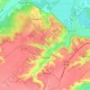
Matiashivka topographic map

Click on the map to display elevation.

About this map

Name: Matiashivka topographic map, elevation, terrain.

Location: Matiashivka, Obukhiv Urban Hromada, Obukhiv Raion, Kyiv Oblast, 08700, Ukraine (50.00820 30.60095 50.04820 30.64095)

Average elevation: 531 ft

Minimum elevation: 358 ft

Maximum elevation: 650 ft

Other topographic maps

Click on a map to view its topography, its elevation and its terrain.
Obukhiv

Ukraine > Kyiv Oblast > Obukhiv Raion

Average elevation: 489 ft

Leonivka

Ukraine > Kyiv Oblast > Obukhiv Raion

Average elevation: 607 ft

Gear up for your next adventure:

🛰️Handheld GPS Units - Professional satellite navigators for precise backcountry mapping
🎒Trekking Poles - Sturdy poles for balance and stability on rough terrain
🧴Hand Sanitizer - Keep hands clean while hiking
📶Satellite Messenger - Communication device off‑grid
🥾Men's Hiking Boots - Durable, waterproof footwear for rugged terrain and steep inclines

As an Amazon Associate, this site earns from qualifying purchases at no extra cost to you.