Geolocate

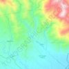
Taguibo topographic map

Click on the map to display elevation.

About this map

Name: Taguibo topographic map, elevation, terrain.

Location: Taguibo, Mati, Davao Oriental, Davao Region, 8200, Philippines (7.01443 126.18740 7.05443 126.22740)

Average elevation: 1,010 ft

Minimum elevation: 413 ft

Maximum elevation: 1,906 ft

Other topographic maps

Click on a map to view its topography, its elevation and its terrain.
Mayo River

Philippines > Davao Oriental > Mati

Average elevation: 1,512 ft

Gear up for your next adventure:

🧣Hiking Neck Gaiter - Multi‑use neck protection for outdoor weather
⌚GPS Sports Watch - GPS watch for running, hiking and training
🔥Camping Stove - Portable stove for camping and backcountry cooking
🎒Trail Energy Bars - High‑calorie bars for hiking energy
🧯Emergency Survival Kit - All‑in‑one survival essentials for the backcountry

As an Amazon Associate, this site earns from qualifying purchases at no extra cost to you.