Geolocate

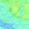
Belhaven topographic map

Click on the map to display elevation.

About this map
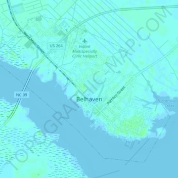
Name: Belhaven topographic map, elevation, terrain.

Location: Belhaven, Beaufort County, North Carolina, 27810, United States (35.52916 -76.64376 35.55468 -76.60566)

Average elevation: 3 ft

Minimum elevation: -7 ft

Maximum elevation: 20 ft

Beaufort County trails, hiking, mountain biking, running and outdoor activities

Other topographic maps

Click on a map to view its topography, its elevation and its terrain.
Porter

United States > North Carolina > Beaufort County

Average elevation: 23 ft

Rover

United States > North Carolina > Beaufort County

Average elevation: 36 ft

Gear up for your next adventure:

🚁Photography Drones - Capture stunning aerial views of landforms and topography
🥩Freeze-Dried Meals - Nutritious and lightweight food for remote expeditions
🔌USB Car Charger - Car charger for on‑the‑go power needs
🎒Outdoor Daypacks - Lightweight backpacks designed for carrying maps and essential gear
🪶LED Camping Lantern - Bright lantern for camp lighting

As an Amazon Associate, this site earns from qualifying purchases at no extra cost to you.