Geolocate

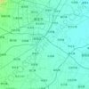
Lingdongcun topographic map

Click on the map to display elevation.

About this map

Name: Lingdongcun topographic map, elevation, terrain.

Location: Lingdongcun, Baoding City, Hebei, China (39.06560 115.14205 39.10560 115.18205)

Average elevation: 653 ft

Minimum elevation: 446 ft

Maximum elevation: 1,535 ft

Other topographic maps

Click on a map to view its topography, its elevation and its terrain.

Tang County

China > Hebei > Baoding City

Average elevation: 1,063 ft

Nandayuan

China > Hebei > Baoding City

Average elevation: 62 ft

Qingyuan District

China > Hebei > Baoding City

Average elevation: 66 ft

Laiyuan County

China > Hebei > Baoding City

Average elevation: 3,323 ft

Acient Lotus Pool

China > Hebei > Baoding City

Average elevation: 72 ft

Acient Lotus Pool

China > Hebei > Baoding City

Average elevation: 72 ft

Gear up for your next adventure:

🔊Portable Camp Speaker - Music and alerts at camp
🔌USB Car Charger - Car charger for on‑the‑go power needs
🪑Portable Camp Table - Compact table for campsite meals
🩳Quick‑Dry Hiking Shorts - Comfortable and quick‑dry shorts for summer hiking
❄️Traction Cleats - Prevent slips on icy trails during winter hikes

As an Amazon Associate, this site earns from qualifying purchases at no extra cost to you.