Geolocate

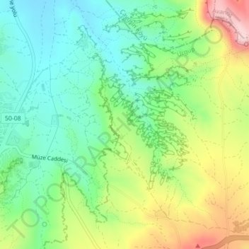
Cappadocia topographic map

Click on the map to display elevation.

Cappadocia

Cappadocia lies in central Anatolia, in the heartland of what is now Turkey. The relief consists of a high plateau over 1,000 m in altitude that is pierced by volcanic peaks, with Mount Erciyes (ancient Argaeus) near Kayseri (ancient Caesarea) being the tallest at 3,916 m. The boundaries of historical Cappadocia are vague, particularly towards the west.

Wikipedia (CC-BY-SA 3.0)

About this map

Name: Cappadocia topographic map, elevation, terrain.

Location: Cappadocia, Göreme, Nevşehir, Central Anatolia Region, 50180, Turkey (37.63861 33.84552 39.63861 35.84552)

Average elevation: 4,285 ft

Minimum elevation: 1,772 ft

Maximum elevation: 12,566 ft

Other topographic maps

Click on a map to view its topography, its elevation and its terrain.
Göreme Historical National Park

Turkey > Nevşehir > Göreme

Average elevation: 3,720 ft

Gear up for your next adventure:

🌎3D Topographic Globes - Raised relief globes for a tactile understanding of geography
🎁Geography Themed Gifts - Unique gift ideas for map lovers and geography enthusiasts
🧦Hiking Socks - Comfortable socks to prevent blisters on long hikes
🧣Hiking Neck Gaiter - Multi‑use neck protection for outdoor weather
🧭GPS Watch Accessories - Bands and chargers for GPS watches

As an Amazon Associate, this site earns from qualifying purchases at no extra cost to you.