
Granbury topographic map
Click on the map to display elevation.
About this map
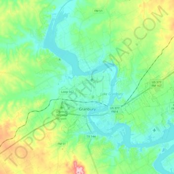
Name: Granbury topographic map, elevation, terrain.
Location: Granbury, Hood County, Texas, 76048, United States (32.41132 -97.83436 32.49073 -97.68193)
Average elevation: 794 ft
Minimum elevation: 689 ft
Maximum elevation: 1,207 ft
Hood County trails, hiking, mountain biking, running and outdoor activities
Other topographic maps
Click on a map to view its topography, its elevation and its terrain.