
Thank you for supporting this site ❤️
Make a donation
Make a donation
Gear up for your next adventure:
As an Amazon Associate, this site earns from qualifying purchases at no extra cost to you.
Bighorn topographic map
Click on the map to display elevation.
Thank you for supporting this site ❤️
Make a donation
Make a donation
Gear up for your next adventure:
As an Amazon Associate, this site earns from qualifying purchases at no extra cost to you.
About this map
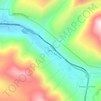
Name: Bighorn topographic map, elevation, terrain.
Location: Bighorn, Vail, Eagle County, Colorado, United States (39.61665 -106.31725 39.65665 -106.27725)
Average elevation: 9,495 ft
Minimum elevation: 8,301 ft
Maximum elevation: 11,293 ft
Eagle County trails, hiking, mountain biking, running and outdoor activities
Thank you for supporting this site ❤️
Make a donation
Make a donation
Gear up for your next adventure:
As an Amazon Associate, this site earns from qualifying purchases at no extra cost to you.