Geolocate

Mambog topographic map

Click on the map to display elevation.

About this map
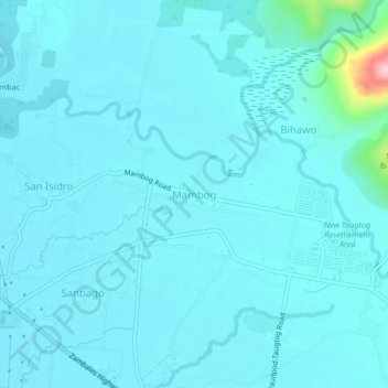
Name: Mambog topographic map, elevation, terrain.

Location: Mambog, Botolan, Zambales, Central Luzon, 2202, Philippines (15.29295 120.01063 15.33295 120.05063)

Average elevation: 69 ft

Minimum elevation: 7 ft

Maximum elevation: 738 ft

Gear up for your next adventure:

🪶Fire Starter Kit - Reliable fire starter for survival and camping
🌎3D Topographic Globes - Raised relief globes for a tactile understanding of geography
💧Water Purification System - Clean water on the trail with reliable purifiers
🎒Day Hiking Backpack - Lightweight backpack perfect for day trips and outdoor adventures
☀️Outdoor Sunscreen - High protection sunscreen for outdoor activities

As an Amazon Associate, this site earns from qualifying purchases at no extra cost to you.