Geolocate

Reno topographic map

Click on the map to display elevation.

About this map

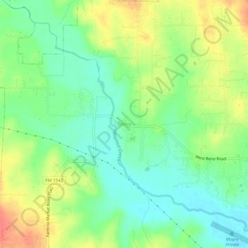
Name: Reno topographic map, elevation, terrain.

Location: Reno, Parker County, Texas, United States (32.92438 -97.60062 32.96438 -97.56062)

Average elevation: 741 ft

Minimum elevation: 663 ft

Maximum elevation: 850 ft

Gear up for your next adventure:

📚Navigation Handbooks - Master the art of reading topographic maps and using a compass
💧Water Filtration Bottles - Safely drink from streams and lakes while exploring
🧭Map Reading Tools - Tools and kits for map navigation
🪶Camping Sleeping Pad - Comfortable sleeping pad for backpacking
🪶LED Camping Lantern - Bright lantern for camp lighting

As an Amazon Associate, this site earns from qualifying purchases at no extra cost to you.