
Thank you for supporting this site ❤️
Make a donation
Make a donation
Gear up for your next adventure:
As an Amazon Associate, this site earns from qualifying purchases at no extra cost to you.
Ambadandegama topographic map
Click on the map to display elevation.
Thank you for supporting this site ❤️
Make a donation
Make a donation
Gear up for your next adventure:
As an Amazon Associate, this site earns from qualifying purchases at no extra cost to you.
About this map
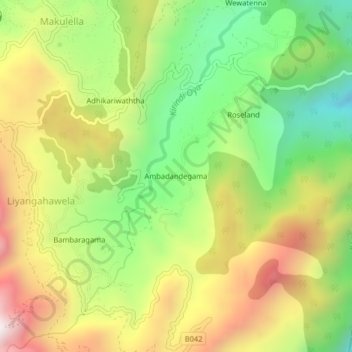
Name: Ambadandegama topographic map, elevation, terrain.
Location: Ambadandegama, Badulla District, Uva Province, Sri Lanka (6.79643 81.02380 6.83643 81.06380)
Average elevation: 4,012 ft
Minimum elevation: 2,490 ft
Maximum elevation: 5,814 ft
Thank you for supporting this site ❤️
Make a donation
Make a donation
Gear up for your next adventure:
As an Amazon Associate, this site earns from qualifying purchases at no extra cost to you.