
Thank you for supporting this site ❤️
Make a donation
Make a donation
Gear up for your next adventure:
As an Amazon Associate, this site earns from qualifying purchases at no extra cost to you.
Borger topographic map
Click on the map to display elevation.
Thank you for supporting this site ❤️
Make a donation
Make a donation
Gear up for your next adventure:
As an Amazon Associate, this site earns from qualifying purchases at no extra cost to you.
About this map
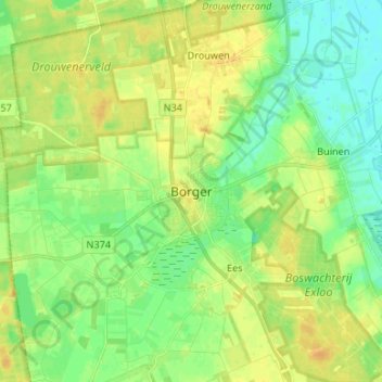
Name: Borger topographic map, elevation, terrain.
Location: Borger, Borger-Odoorn, Drenthe, Nederland, 9531, Nederland (52.88407 6.75056 52.96407 6.83056)
Average elevation: 56 ft
Minimum elevation: 16 ft
Maximum elevation: 95 ft
Thank you for supporting this site ❤️
Make a donation
Make a donation
Gear up for your next adventure:
As an Amazon Associate, this site earns from qualifying purchases at no extra cost to you.