
Draper topographic map
Click on the map to display elevation.
Draper
Draper's climate is roughly identical to that of other Salt Lake City suburbs. However, due to being further away from the Great Salt Lake, varied elevation, and from the downtown urban heat island effect, Draper experiences a slightly drier winter, and more extremes in temperatures.
About this map
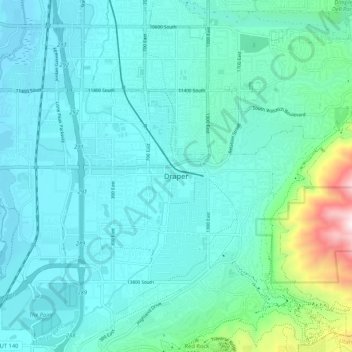
Name: Draper topographic map, elevation, terrain.
Location: Draper, Salt Lake County, Utah, 84020, United States (40.48478 -111.90280 40.56478 -111.82280)
Average elevation: 4,803 ft
Minimum elevation: 4,308 ft
Maximum elevation: 7,654 ft
Salt Lake County trails, hiking, mountain biking, running and outdoor activities