
Thank you for supporting this site ❤️
Make a donation
Make a donation
Gear up for your next adventure:
As an Amazon Associate, this site earns from qualifying purchases at no extra cost to you.
Maimelane topographic map
Click on the map to display elevation.
Thank you for supporting this site ❤️
Make a donation
Make a donation
Gear up for your next adventure:
As an Amazon Associate, this site earns from qualifying purchases at no extra cost to you.
About this map
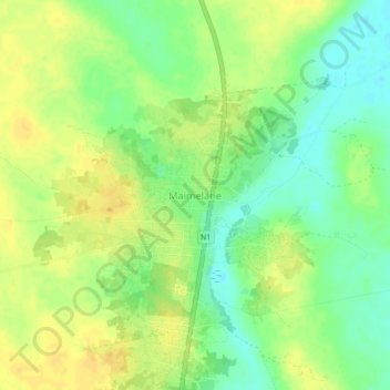
Name: Maimelane topographic map, elevation, terrain.
Location: Maimelane, Inhassoro, Inhambane Province, Mozambique (-21.68522 35.07350 -21.64522 35.11350)
Average elevation: 79 ft
Minimum elevation: 30 ft
Maximum elevation: 115 ft
Thank you for supporting this site ❤️
Make a donation
Make a donation
Gear up for your next adventure:
As an Amazon Associate, this site earns from qualifying purchases at no extra cost to you.