Geolocate

Trappa topographic map

Click on the map to display elevation.

About this map

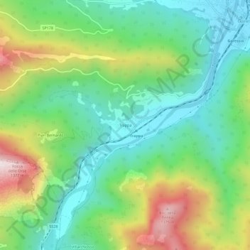
Name: Trappa topographic map, elevation, terrain.

Location: Trappa, Garessio, Cuneo, Piemonte, 12075, Italia (44.16626 7.97194 44.20626 8.01194)

Average elevation: 2,782 ft

Minimum elevation: 1,886 ft

Maximum elevation: 4,557 ft

Gear up for your next adventure:

📚USA Hiking Guide Books - Top trail guides and map books
🛏️Cold Weather Sleeping Bag - Warm sleeping bag for cold conditions
🌐World Map Poster - Decorative world maps with topographic info
🛶Inflatable Kayak - Portable kayak for rivers, lakes, and expeditions
📌Outdoor GPS Map App - Apps and devices for digital topographic navigation

As an Amazon Associate, this site earns from qualifying purchases at no extra cost to you.