Geolocate

Washington topographic map

Click on the map to display elevation.

About this map

Name: Washington topographic map, elevation, terrain.

Location: Washington, Storrington, Horsham, West Sussex, England, United Kingdom (50.87960 -0.43123 50.93065 -0.37689)

Average elevation: 302 ft

Minimum elevation: 46 ft

Maximum elevation: 781 ft

Other topographic maps

Click on a map to view its topography, its elevation and its terrain.
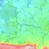
Cootham

United Kingdom > England > West Sussex > Horsham > Storrington

Average elevation: 167 ft

Gear up for your next adventure:

🔥Plasma Lighters - Windproof lighters that work in any weather condition
☀️Outdoor Sunscreen - High protection sunscreen for outdoor activities
🧦Hiking Socks - Comfortable socks to prevent blisters on long hikes
🗻Climbing Gear Basics - Essential gear for beginner climbers
🔥Camping Stove - Portable stove for camping and backcountry cooking

As an Amazon Associate, this site earns from qualifying purchases at no extra cost to you.