
Oakville topographic map
Interactive map
Click on the map to display elevation.
About this map
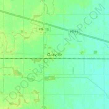
Name: Oakville topographic map, elevation, terrain.
Location: Oakville, Manitoba, Canada (49.89064 -98.03765 49.97064 -97.95765)
Average elevation: 814 ft
Minimum elevation: 797 ft
Maximum elevation: 837 ft