
Huberdeau topographic map
Interactive map
Click on the map to display elevation.
About this map
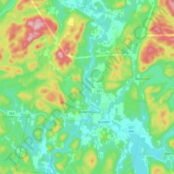
Name: Huberdeau topographic map, elevation, terrain.
Location: Huberdeau, Les Laurentides, Laurentides, Quebec, Canada (45.92914 -74.71039 46.05934 -74.61351)
Average elevation: 873 ft
Minimum elevation: 551 ft
Maximum elevation: 1,680 ft