
Vaupés topographic map
Interactive map
Click on the map to display elevation.
About this map
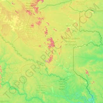
Name: Vaupés topographic map, elevation, terrain.
Location: Vaupés, Colombia (-1.22767 -72.03294 2.08035 -69.11563)
Average elevation: 571 ft
Minimum elevation: 203 ft
Maximum elevation: 2,096 ft
Other topographic maps
Click on a map to view its topography, its elevation and its terrain.