
Thank you for supporting this site ❤️
Make a donation
Make a donation
Gear up for your next adventure:
As an Amazon Associate, this site earns from qualifying purchases at no extra cost to you.
Liri topographic map
Click on the map to display elevation.
Thank you for supporting this site ❤️
Make a donation
Make a donation
Gear up for your next adventure:
As an Amazon Associate, this site earns from qualifying purchases at no extra cost to you.
About this map
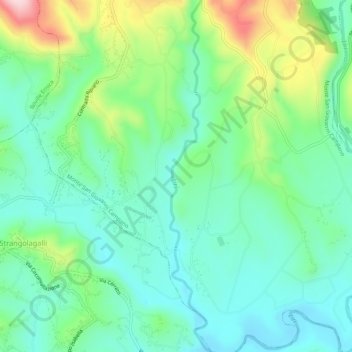
Name: Liri topographic map, elevation, terrain.
Location: Liri, Monte San Giovanni Campano, Frosinone, Lazio, Italia (41.58867 13.51430 41.62856 13.52053)
Average elevation: 627 ft
Minimum elevation: 354 ft
Maximum elevation: 1,312 ft
Thank you for supporting this site ❤️
Make a donation
Make a donation
Gear up for your next adventure:
As an Amazon Associate, this site earns from qualifying purchases at no extra cost to you.