
Thank you for supporting this site ❤️
Make a donation
Make a donation
Gear up for your next adventure:
As an Amazon Associate, this site earns from qualifying purchases at no extra cost to you.
Hargawan topographic map
Click on the map to display elevation.
Thank you for supporting this site ❤️
Make a donation
Make a donation
Gear up for your next adventure:
As an Amazon Associate, this site earns from qualifying purchases at no extra cost to you.
About this map
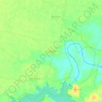
Name: Hargawan topographic map, elevation, terrain.
Location: Hargawan, Morena Tahsil, Morena, Madhya Pradesh, India (26.48249 78.09951 26.52249 78.13951)
Average elevation: 554 ft
Minimum elevation: 505 ft
Maximum elevation: 610 ft
Thank you for supporting this site ❤️
Make a donation
Make a donation
Gear up for your next adventure:
As an Amazon Associate, this site earns from qualifying purchases at no extra cost to you.