
Thank you for supporting this site ❤️
Make a donation
Make a donation
Gear up for your next adventure:
As an Amazon Associate, this site earns from qualifying purchases at no extra cost to you.
Gavião topographic map
Click on the map to display elevation.
Thank you for supporting this site ❤️
Make a donation
Make a donation
Gear up for your next adventure:
As an Amazon Associate, this site earns from qualifying purchases at no extra cost to you.
About this map
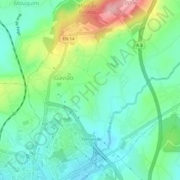
Name: Gavião topographic map, elevation, terrain.
Location: Gavião, Mouquim, Vila Nova de Famalicão, Braga, Portugal (41.41301 -8.52039 41.43630 -8.49345)
Average elevation: 430 ft
Minimum elevation: 272 ft
Maximum elevation: 807 ft
Thank you for supporting this site ❤️
Make a donation
Make a donation
Gear up for your next adventure:
As an Amazon Associate, this site earns from qualifying purchases at no extra cost to you.