
初头朗镇 topographic map
Interactive map
Click on the map to display elevation.
About this map
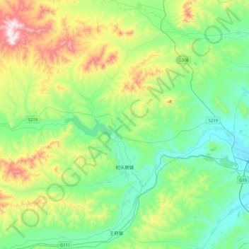
Name: 初头朗镇 topographic map, elevation, terrain.
Location: 初头朗镇, 松山区, 赤峰市, 内蒙古自治区, 中国 (42.25387 118.33657 42.49629 118.74900)
Average elevation: 2,677 ft
Minimum elevation: 1,955 ft
Maximum elevation: 4,577 ft
Other topographic maps
Click on a map to view its topography, its elevation and its terrain.