
夏家店乡 topographic map
Interactive map
Click on the map to display elevation.
About this map
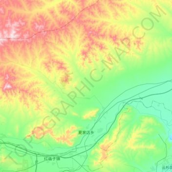
Name: 夏家店乡 topographic map, elevation, terrain.
Location: 夏家店乡, 松山区, 赤峰市, 内蒙古自治区, 中国 (42.31159 118.90275 42.50207 119.22476)
Average elevation: 2,175 ft
Minimum elevation: 1,430 ft
Maximum elevation: 3,527 ft
Other topographic maps
Click on a map to view its topography, its elevation and its terrain.