
Make a donation
Gear up for your next adventure:
As an Amazon Associate, this site earns from qualifying purchases at no extra cost to you.
Le Brandais topographic map
Click on the map to display elevation.
Make a donation
Gear up for your next adventure:
As an Amazon Associate, this site earns from qualifying purchases at no extra cost to you.
About this map
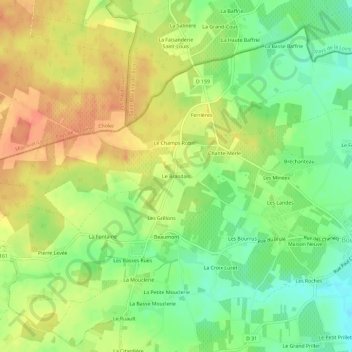
Name: Le Brandais topographic map, elevation, terrain.
Average elevation: 220 ft
Minimum elevation: 141 ft
Maximum elevation: 289 ft
Make a donation
Gear up for your next adventure:
As an Amazon Associate, this site earns from qualifying purchases at no extra cost to you.
Other topographic maps
Click on a map to view its topography, its elevation and its terrain.
79290
France > Nouvelle-Aquitaine > Deux-Sèvres > Loretz-d'Argenton > Le Petit Ursay
Average elevation: 180 ft
Argenton-l'Église
France > Nouvelle-Aquitaine > Deux-Sèvres > Loretz-d'Argenton
Average elevation: 190 ft
Bouillé-Loretz
France > Nouvelle-Aquitaine > Deux-Sèvres > Loretz-d'Argenton
Le climat du département des Deux-Sèvres est de type océanique doux. La faiblesse des altitudes n’entraîne pas de grandes modifications climatiques au sein du département.
Average elevation: 203 ft