Geolocate

Healey topographic map

Interactive map

Click on the map to display elevation.

About this map

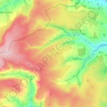
Name: Healey topographic map, elevation, terrain.

Location: Healey, Harrogate, North Yorkshire, England, United Kingdom (54.17489 -1.88616 54.24246 -1.71031)

Average elevation: 725 ft

Minimum elevation: 210 ft

Maximum elevation: 1,430 ft

Other topographic maps

Click on a map to view its topography, its elevation and its terrain.

Pinewoods

United Kingdom > England > North Yorkshire > Harrogate

Pinewoods, Duchy, Harrogate, North Yorkshire, England, United Kingdom

Average elevation: 456 ft

High Ellington

United Kingdom > England > North Yorkshire > Harrogate

High Ellington, Ellington High and Low, Harrogate, North Yorkshire, England, HG4 4PR, United Kingdom

Average elevation: 466 ft

Milby Cut

United Kingdom > England > North Yorkshire > Harrogate > Aldborough > Milby

Milby Cut, Milby, Aldborough, Harrogate, North Yorkshire, England, YO51 9HQ, United Kingdom

Average elevation: 66 ft

Heyshaw

United Kingdom > England > North Yorkshire > Harrogate > Heyshaw

Heyshaw, Dacre, Harrogate, North Yorkshire, Yorkshire and the Humber, England, HG3 4HD, United Kingdom

Average elevation: 725 ft

Ripon

United Kingdom > England > North Yorkshire > Harrogate

Ripon, Harrogate, North Yorkshire, England, United Kingdom

Average elevation: 151 ft