
Thank you for supporting this site ❤️
Make a donation
Make a donation
Gear up for your next adventure:
As an Amazon Associate, this site earns from qualifying purchases at no extra cost to you.
Pussellawa topographic map
Click on the map to display elevation.
Thank you for supporting this site ❤️
Make a donation
Make a donation
Gear up for your next adventure:
As an Amazon Associate, this site earns from qualifying purchases at no extra cost to you.
About this map
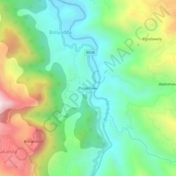
Name: Pussellawa topographic map, elevation, terrain.
Location: Pussellawa, Boliyadda, Badulla District, Uva Province, Sri Lanka (7.03674 81.03836 7.07674 81.07836)
Average elevation: 1,883 ft
Minimum elevation: 961 ft
Maximum elevation: 3,625 ft
Thank you for supporting this site ❤️
Make a donation
Make a donation
Gear up for your next adventure:
As an Amazon Associate, this site earns from qualifying purchases at no extra cost to you.