Geolocate

Athmallik topographic map

Click on the map to display elevation.

About this map

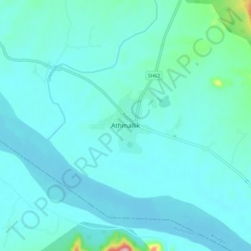
Name: Athmallik topographic map, elevation, terrain.

Location: Athmallik, Anugul, Odisha, 759125, India (20.68185 84.49475 20.76185 84.57475)

Average elevation: 285 ft

Minimum elevation: 203 ft

Maximum elevation: 968 ft

Gear up for your next adventure:

🔭Compact Binoculars - HD vision for scouting terrain and identifying distant landmarks
🥾Men's Hiking Boots - Durable, waterproof footwear for rugged terrain and steep inclines
❄️Traction Cleats - Prevent slips on icy trails during winter hikes
🧭Compass with Lanyard - Easy‑carry compass for navigation
🛏️Cold Weather Sleeping Bag - Warm sleeping bag for cold conditions

As an Amazon Associate, this site earns from qualifying purchases at no extra cost to you.